
Sources for a Ritchie County Property Block
Ritchie County offers no automatic buffer or one-click neighbors tool. The work is manual but simple. Identify the subject polygon in WV Property Assessment. Write down each adjacent map and parcel number, then run every key through the assessor search. A street address will not always narrow things down. A recorded plat shows the surrounding lots.
| Source | What It Shows for Nearby Parcels | Access |
|---|---|---|
| WV Property Assessment Viewer | Surface tax polygons, map context, selected parcel attributes | Search and identify one polygon at a time |
| Ritchie Assessor | Owner field, account, district, map/parcel, legal description | Parcel Address, owner, or map/parcel search |
| County Clerk plat books | Lot, block, street, easement, and replat records | IDX categories or clerk counter request |
| Survey or legal description | Boundary evidence and land calls | Recorded instrument and licensed surveyor |
The state viewer displays the map and assessment entry point for locating county parcels.
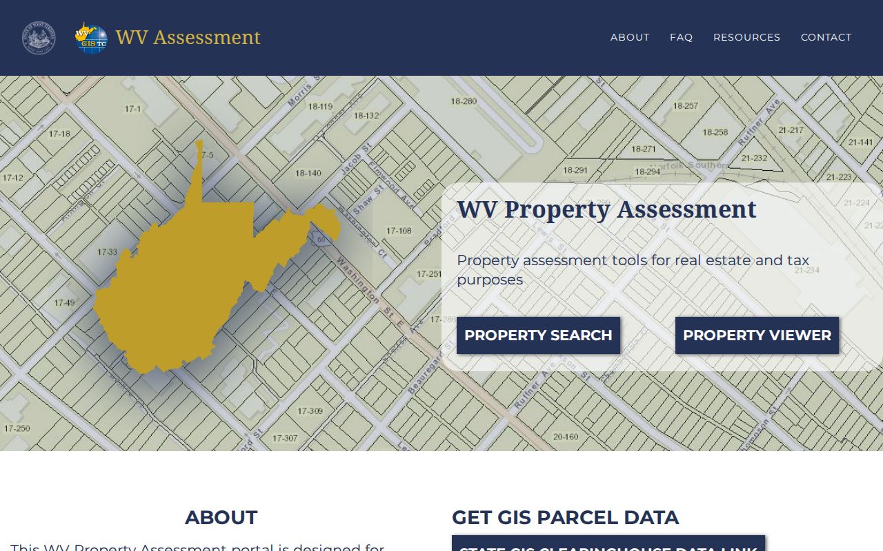
That view is a general entry screen, not a Ritchie County neighbor result. Open the live map and click each polygon to confirm its parcel key yourself.
Mapping Parcels Around a Ritchie County Address
Begin with the assessor's Parcel Address field or an owner search. Save the account number and the four-part map and parcel key. The state viewer may offer property search and identify tools. It has no named buffer function. Work the identify option by hand. Select the subject parcel, and note every polygon that touches it on screen. Then click each one to read its displayed key.
- Locate the subject parcel using its address or assessment key.
- Record the district and map/parcel exactly as displayed.
- Click each nearby polygon and note its map/parcel, including any gaps or road areas.
- Search each key in the assessor to see the owner name and situs or mailing fields.
- Compare a plat or legal description before calling a polygon an abutting parcel.
If the map's address search falters, go back to the assessor form and use the parcel key. The form has four map and parcel controls. Their exact padding is not documented anywhere official. Never reformat the number into a pattern you guessed. When you save a map image, include the date, because assessment layers refresh each year.
- Adjacent
- Near or next to another map feature; visual contact does not prove a legal boundary.
- Abutting
- Sharing a boundary under the legal description or survey.
- Parcel key
- The county's tax-map identifier, entered through four fields in the assessor form.
- Plat
- A recorded land division map that can name lots, blocks, roads, and easements.
- Buffer
- A GIS selection zone around a feature; the Ritchie viewer's buffer tool was not verified.
Ritchie County Owner Names Beside the Parcel
Once you have an adjacent map and parcel key, search it in the assessor. The owner field is an assessment entry. The mailing address can differ from the situs address. A nearby parcel may belong to an LLC, a trustee, an estate, or an out-of-county owner. Those names do not tell you who occupies the land. For an unfamiliar entity, check the state business index. Tie it to the ground through a deed. Apply the same careful cross-check to every parcel on the block. Save the owner spelling, account, map and parcel number, district, and legal description. Save the tax year too, and the date of your lookup. The clerk's deed index may show an owner record newer than the assessor roll. Keep both dates rather than picking one without the custodian's context. For one parcel's present owner, the Ritchie County current-owner lookup explains the roll-versus-deed check in detail.
Can the Ritchie Assessor List a Whole Street?
The Ritchie assessor form includes a Parcel Address text input. However, it has no explicit street-wide list mode. A broad street string may return several records at once. The same is true for a district and map range. Partial-match behavior is not documented. Results can therefore be unpredictable. For a full street listing, ask the assessor what query or public data extract exists. Do not assume a portal export. Search one known address first. Then use the map and parcel numbers to find nearby tax polygons. Reading the owner field for each separate parcel beats guessing from a street-number sequence. Route addresses, side roads, and unincorporated stretches can interrupt an otherwise tidy block.
Ritchie County Plats Reveal Hidden Lots
A street address can hide a plat name. It may also hide a lot number or an old road reference. The County Clerk IDX lists PLAT and PLAT & SURVEY categories. It also includes Road Record, Road Order, Easement, Right of Way, and Ordinance records. A town lot may have shifted through replat, vacation, or street work. Find the source plat and compare its book and page against the deed. Historic maps help normalize a street or community name. The Historical Society links to 1899 maps of Harrisville, Pennsboro, and Cairo. Pennsboro's original town plat came from a surveyor named Penn. The town incorporated in 1885, then became a city in 1915. Those clues guide a search. But only a recorded plat and deed identify the actual land interest. Rural descriptions lean on creek, road, acreage, railroad, mineral, or farm language instead of lot and block. Preserve each parcel's legal text. A surface polygon is never a complete interest map.
Annual Ritchie County Map Updates
The state viewer updates once a year with new assessment data. A recorded owner change may lag behind the map. A parcel split can wait until the county submits its changes. State guidance says map revisions for transfers between July 1 and June 30 should be submitted by February 1 of the next calendar year. The same guidance suggests calling the local assessor. Do so if a line stays stale for two years. None of this fixes a Ritchie-specific update interval. If a neighbor lookup clashes with a fresh deed, use the instrument date. Ask the assessor about a pending map correction. A changed screen is not a new deed. An old screen does not prove the parcel never changed.
Town Lines and Ritchie County Neighbors
A parcel in Ritchie County can sit in Harrisville, Pennsboro, Ellenboro, or open country. The mailing city on an address means little. USPS itself notes that ZIP lines do not have to follow municipal limits. For orientation, the assessor's district and the county GIS map are far better guides. The municipality itself can settle permit, zoning, and annexation questions.
Old records carry names that no longer appear on maps. Harrisville documents may say Solus, Ritchie Court House, or Ritchie Courthouse. Pennsboro deeds may point to the original plat. They may also cite Main Street, Myles Avenue, the depot, or the park area. Ellenboro addresses often cover a rural delivery zone wider than the town itself. Treat these as search contexts rather than formal subdivision names.
Boundary questions deserve official sources. Check the plats and town records. They show which side of a road or stream a parcel occupies. Never infer municipal jurisdiction from a ZIP label or a map color alone.
Limits of Ritchie County Neighbor Records
A GIS viewer maps tax polygons, not people. Two shapes that appear to touch may actually be split by a road right of way, a railroad, or a watercourse. A mapped gap can also divide them. Surface rights and mineral rights can also belong to different parties. Add the mailing-address wrinkle: a neighbor's tax bill may go somewhere far from the parcel. The owner of record field is an ownership entry, not an occupancy record.
Use nearby-owner data lawfully. Adjacent-parcel information is useful for boundary diligence, land history, and civic research. Do not use a name or address to watch, target, threaten, or harass anyone.
Exact boundaries deserve professional attention. A licensed surveyor can reconcile the clerk's plat against the deed description. Tax rolls in Ritchie County record owners of record rather than precise lines. For map reading only, the Ritchie County parcel map reference walks through what the viewer does and does not show. Whatever the assessor lists for a neighboring parcel, describe it honestly as an adjacent tax parcel owner. Never call it a confirmed occupant.