
How to Search Ritchie County Property Records
A good search follows the parcel across offices rather than stopping at one screen. To identify the land first, open the Ritchie County Assessor Property Record Search. Then enter the Parcel Address. Rural or older addresses sometimes miss. An owner spelling or the legal description can work better. Write down what comes back: account, district, map/parcel, situs address, mailing address, legal description, and deed book and page. Those keys keep two same-named owners from blending together.
Next, take the owner name or deed reference to the Ritchie County Clerk Document Inquiry. Its IDX is a party and instrument index. Grantor or grantee searching beats an address-only query. The Sheriff Tax Inquiry shows whether a bill is paid or due. The statewide viewer places the tax polygon beside nearby roads. None of these replaces the recorded instrument, the written tax certificate, or a survey.
- Search the assessor by address, owner, account, or map/parcel and save the parcel keys.
- Use the deed book/page or owner spelling to locate the related County Clerk index entry.
- Compare the sheriff ticket and tax year with the parcel and account numbers.
- Open the WV Property Assessment Viewer to orient the parcel and check nearby polygons.
- Ask the custodian for older books, document images, certified copies, or a correction when the online record is incomplete.
This route keeps the search pointed. A parcel address points to the land itself. An owner name points to the people or entities an index recorded. The clerk's legal description, in turn, explains exactly what an instrument conveyed.
Offices Behind Ritchie County Records
Ritchie County has no separate city assessors or recorders. Harrisville serves as the county seat and the county-office address, yet deeds, assessments, tax maps, and tax tickets cover parcels in Pennsboro, Ellenboro, and rural communities alike. The division of labor is simple. The assessor sets property values while levying bodies set taxes; the clerk records instruments, and the sheriff collects property taxes.
Ritchie County Clerk
115 East Main Street, Room 201
Harrisville, WV 26362
304-643-2164 ext. 221
Ritchie County Assessor
115 East Main Street, Room 203
Harrisville, WV 26362
304-643-2164
Sheriff Tax Office
109 East North Street, Suite 101
Harrisville, WV 26362
304-643-2262
The assessor's office page lists the contact route and explains the difference between property valuation and tax levies.
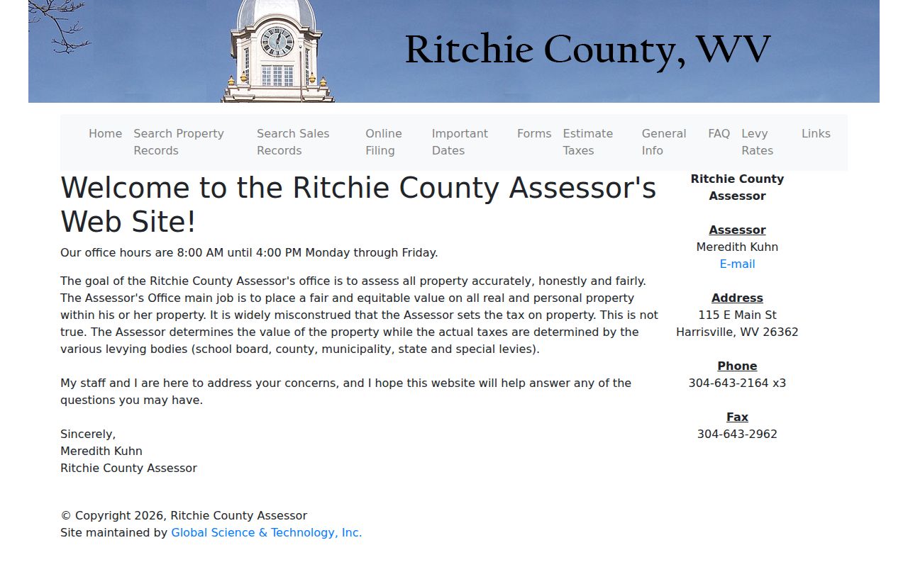
For a value correction, use the assessor's contact information. For a bill or payment status, go to the Sheriff Tax Office instead.
Beyond deeds, the County Clerk holds wills, probate and fiduciary files. Vital records, liens, plats, road records, elections, and other county instruments sit there too. Circuit and family court documents sit on the Judiciary's WVPASS portal. Magistrate case information, meanwhile, runs through MCRSearch. A document missing from the internet may still rest at the courthouse. It may also sit within a historic collection.
Types of Ritchie County Property Records
One address can leave several record trails. Ritchie County property records include tax data, conveyances, financing instruments, map material, and local permits. The right record depends on the question you bring. A deed shows what was recorded, an assessment shows the county's tax value, and a tax ticket shows billing activity.
| Record | What It Shows | Keeper | Access Route |
|---|---|---|---|
| Deed and plat | Parties, legal description, transfer and map references | County Clerk | IDX, clerk counter, mail request, historic books |
| Mortgage, lien, release | Recorded claim, assignment, satisfaction, or right | County Clerk | IDX by party and instrument type |
| Assessment | Owner field, parcel keys, legal text, value, exemption | Assessor | Free county search, office, state viewer |
| Tax ticket | Tax year, billed, paid, due, account and map/parcel | Sheriff | Online inquiry, counter, written tax certificate |
| Permit or zoning file | Local construction application or code decision | Municipality | City office; method differs by town |
For the deed index, use the Ritchie County deed-record search. Assessment and tax details sit on the separate property tax records page. City files can explain construction. They can also explain a street change. A city permit, though, is not proof of ownership and never replaces the county deed.
Ritchie County Assessor Search Fields
The assessor form accepts any mix of criteria. An address is often the easiest entry. The portal also offers fields for Owner Name, Account Number, District, Map/Parcel, Property Type, Legal Description, and Deed Book/Page. Enter owner names as LAST NAME FIRST NAME, with no commas. District and property-type choices are county-defined. Check the live dropdown rather than assuming a particular option name.
| Field | Use | Limit to Keep in Mind |
|---|---|---|
| Parcel Address | Start from a street or rural address | Older road names and mailing addresses may differ |
| Owner Name | Find records under a person or entity | Use surname first; same-name matches need parcel checks |
| Account # | Carry the assessment account to tax questions | Can change after corrections or parcel changes |
| District and Map/Parcel | Pinpoint county tax-map location | Map/Parcel uses four controls; preserve exact displayed parts |
| Legal Description | Find a lot, acreage, creek, road, or mineral phrase | Try a short distinct phrase first |
| Deed Book/Page | Bridge a tax card to a recorded entry | Check later correction or re-recording instruments |
A disputed owner field or a parcel split is best settled by contacting the office and asking how to correct the assessment record. Treat the office search as the starting record, not a legal conclusion about title. In practice, the search fields take an address or an owner name. They lead straight to the county parcel key.
The Ritchie County Assessor Property Record Search page displays its owner, parcel address, account, district, map/parcel, property type, and legal-description inputs. Deed-reference inputs appear there too, for public use.
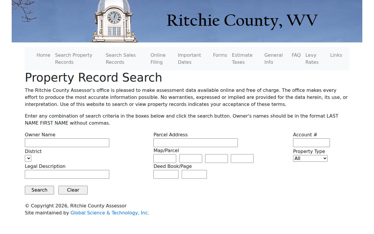
The field list helps you pick a first search key. When ownership or boundaries matter, a resulting parcel still needs a clerk deed check.
What the Ritchie County Clerk IDX Indexes
The County Clerk's Document Inquiry splits its holdings into indexes and sub-indexes. Those groups are Deeds, Liens, Miscellaneous, Fiduciary, and Vitals. Roles you can search include grantor, grantee, creditor, and debtor. Results can display date, document, book/page, page count, name, cross-date, status, and instrument reference. Those are index fields only. The full image, when one is available, carries the actual clauses and the legal description.
Conveyance documents cover deeds, quitclaims, correction deeds, deeds with plats, and conveyances. The lien and financing side holds deeds of trust, mortgages, assignments, and mechanic's liens. It also covers tax liens, judgment liens, easements, rights of way, oil-and-gas leases, timber instruments, releases, and reports of sale under trust deed. A mortgage-only search can overlook a deed of trust. Always chase the original filing plus any termination or correction that followed.
The County Clerk Document Inquiry page displays its name, index, document, book, and instrument controls. The office states no online cutoff year, so the founding-era paper volumes still matter.

Have a name, book/page, date, and instrument type ready when you request a copy from the clerk. The recording rules are specific. Recorded documents need a 2.5-inch top-right margin for validation. One check can cover up to ten documents. Submit four copies of the Sales Listing Form with any recording. Check the clerk's fee schedule for current copy and recording costs before mailing papers.
Ritchie County Tax Tickets and Sheriff Inquiry
The Sheriff Tax Inquiry is separate from the assessor's value search. It can display year, ticket, name, total paid, total billed, first half, second half, total due, account number, map/parcel, and description. It also shows billing address. Those columns tie a tax year to the parcel. A visible balance still is not a certificate of tax status. For a closing, redemption, or title review, request a formal written certificate. The certificate comes from the Sheriff's Tax Office.
Assessed value and tax owed are different figures. The assessor sets taxable value. Levying bodies set the rates. The sheriff collects the bill, and each office plays its own role in the final tax bill. Online payment routing is separate from inquiry. The clerk's recording-copy fees are separate again. One office's payment screen is never a combined property-record account.
The Ritchie County Tax Inquiry page shows the tax-ticket result columns, including billed, paid, due, account, and map/parcel. It also lists billing address.
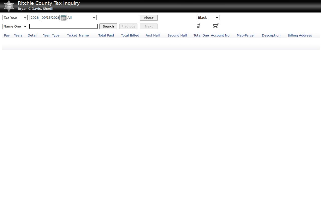
For delinquent property, pull the clerk's delinquent-tax, land-redemption, tax-deed, and notice entries, then check any court case. A portal balance is a lead, not a substitute for a written response from the tax custodian.
Ritchie County Property Maps and Annual Refresh
West Virginia Property Assessment ties together the Property Search and Property Viewer. It also links annual tax-map products and free parcel GIS downloads. Surface polygons, ownership attributes, base imagery, and print-ready tax maps help orient a search. So do tools such as search and identify. The live app can expose different controls than any text description. Do not assume a buffer or an automated adjacent-parcel tool exists without verifying.
Ritchie County map/parcel input uses four text controls rather than one fixed national parcel string. The assessor's Map/Parcel fields can carry a key from the record to the map. So can the viewer. County maps are best-fit tax layers built from deeds and survey work, not legal boundaries. In a boundary dispute, a survey and the recorded legal description control.
The WV Property Assessment viewer identifies the statewide search and map service. Its annual refresh means map or ownership data can trail a recent transfer.
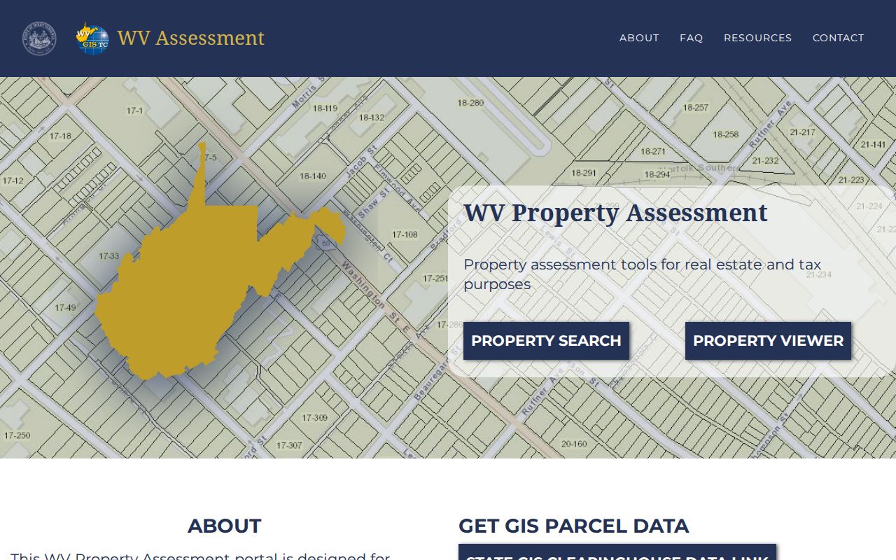
GIS parcel files are available through the WV GIS Technical Center. The state viewer updates once a year with assessment information. For transfers between July 1 and June 30, revisions should be submitted by February 1 of the following calendar year; if lines stay stale after two years, contact the assessor. That is statewide guidance, not a Ritchie-specific closing-to-roll estimate.
Ritchie County Mineral and Timber Records
Ritchie County's recorded land trail reflects oil, gas, timber, farm, and road use. The clerk's IDX instrument list includes oil-and-gas and free-gas leases, royalty deeds, and assignments. It also covers timber deeds or contracts, easements, rights of way, and mineral-related reservations. A surface parcel on the viewer may not represent the whole mineral estate. A name on a surface tax card cannot tell you everything. Someone else may hold a lease, royalty, or subsurface interest.
Search the clerk index by party and by document type. Read the exact legal description and any reservation language. Then look for later assignments, releases, terminations, or correction deeds. A lease may cite acreage or a creek rather than a house number. The parcel polygon may cover the surface alone. The instrument may describe a split or separate interest.
For fixtures, extracted minerals, timber-to-be-cut, or other collateral, the Secretary of State's UCC search can be a separate lead. The state keeps those filings apart from ordinary real-estate mortgages and land liens. Those liens belong with the County Clerk. An entity result does not prove the business owns a specific parcel. Connect it to a recorded deed before drawing any conclusion.
Historic Ritchie County Books Beyond the Web
The County Clerk says county records date to Ritchie's founding in 1843, but the present IDX does not publish its earliest searchable year. Deed Book, Land Book, Plat Book, Plat & Survey Book, Road Record, and Road Order categories appear in the system. If an online search stops or returns no older entry, ask the clerk which physical or microfilm volumes cover the instrument year rather than concluding that the transfer did not happen.
Ritchie County formed from parts of Wood, Harrison, and Lewis counties. At formation it also included land later assigned to Doddridge and Pleasants, and part of Gilmer County was added in the 1860s. That history can send an older transaction to a predecessor or later county book. Confirm where the land lay at the instrument date before choosing a jurisdiction.
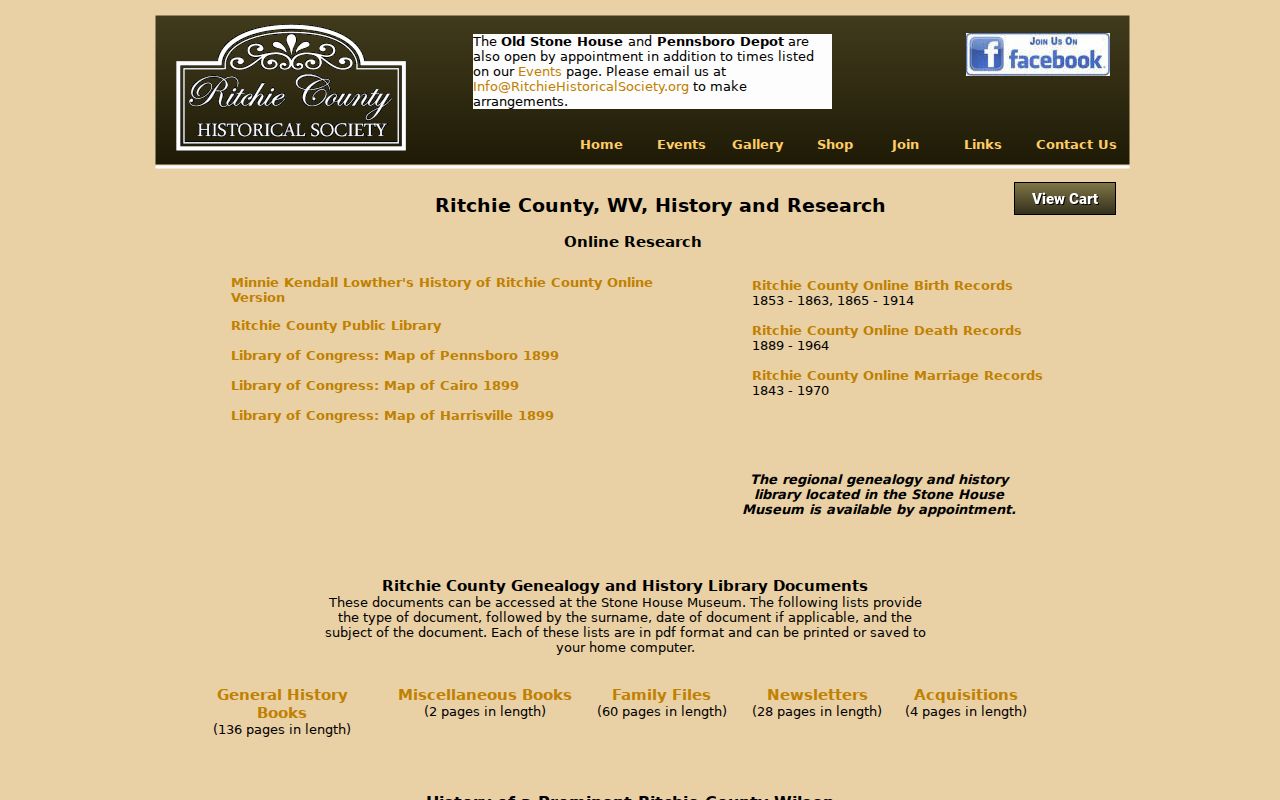
The Ritchie County Historical Society research page lists family files, maps, books, and index links. The linked indexes cover births in 1853-1863 and 1865-1914, deaths in 1889-1964, and marriages in 1843-1970; the gap in the birth run should remain a gap. Those are research leads, not a promise that each certificate is available online.
The Ritchie County Public Library holds a WV History Room and a genealogy collection. It also keeps older newspapers on microfilm. Ask about titles and year ranges before making the trip. No continuous city-directory run is confirmed. Pair a newspaper or family-history clue with the clerk's deed and plat books for the best result.
Ritchie County Court Records Through WVPASS
A land dispute can demand a court search alongside the deed index. The Judiciary's WVPASS public circuit search went statewide on March 10, 2025. Publicly available circuit documents reach back to 1999, per the announcement. Searches are free after registration. Downloads carry a small fee. Search Ritchie County parties and terms like foreclosure, partition, quiet title, lis pendens, judgment, sale, or redemption. Do this when a case ties to a parcel.
Magistrate cases live in a separate statewide system called MCRSearch. It can show case number, parties, filing date, case type, disposition, and a document list. Pulling the documents themselves may still require a call or visit to the local clerk. A party-name hit alone proves nothing about a parcel. Match it to a legal description or a recorded instrument before drawing conclusions.
The Ritchie County Circuit Clerk sits at 115 East Main Street, Room 301, Harrisville. The office can explain archived files and copy requests. WVPASS coverage back to 1999 is a court-document date, not the county's deed-book start. For older court material, ask the clerk about local archive access.
Ritchie County Names That Change the Search
Old Harrisville post-office names can explain a puzzling deed, map, or family file. The file may seem to name a different town. The county history records a sequence. It lists Solus, Ritchie Court House, Harrisville, Ritchie Courthouse, and back to Harrisville in 1985. Try those variants against historic maps and newspapers. Then tie the clue to the parcel's legal description.
Postal geography creates a second mismatch. Ritchie County ZIP codes include several local examples. They cover 26362 for Harrisville, 26415 for Pennsboro, and 26346 for Ellenboro, among others. USPS cautions that ZIP boundaries do not always follow municipal lines. A mailing address with a town name does not place the parcel inside city limits. Use assessor district and GIS context for taxing geography. Ask the municipality about permits or annexation records.
Each town keeps permits differently. Harrisville's online code browser and building checklist offer no searchable historic permit docket. Pennsboro's code reader explains permits but shows no parcel-result search. Ellenboro lists a mayor-council contact without a permit portal. Request the record directly from the town rather than assuming a countywide permit system exists.
Limits of Ritchie County Property Records
A public property record can show an owner name, parcel key, assessed value, filed instrument, or tax balance. Those facts help with purchase diligence, a boundary question, a tax review, a house history, or civic research. But they do not prove anyone lives at the property. They do not guarantee every interest is visible, that taxes are current, or that title is clear.
West Virginia's Freedom of Information Act, W.Va. Code §29B-1 et seq., grants inspection and copy rights subject to exemptions. A public body generally must respond in writing within five business days. Inspection happens during usual business hours. The law never forces a custodian to build a new database. It never forces a legal opinion either. Copy, media, mailing, and special-format charges may apply.
Use records for lawful property research. A clerk index is not a title opinion, GIS lines are not a survey, and an assessor value is not an appraisal. Use owner information for due diligence and civic purposes; do not use public data to stalk, threaten, or harass anyone.
For a specific question, ask the office holding the record. The County Clerk keeps instruments. The assessor keeps assessment entries. The sheriff handles tax tickets. A surveyor or title professional resolves what public screens cannot, and West Virginia's unclaimed property search covers money owed to a person, not real estate.